
The National Weather Service has issued a Heat Advisory for central, northern, and southern Maryland, the District of Columbia, and central and northern Virginia, effective from 11 a.m. to 8 p.m.
Heat index values are expected to reach up to 108 degrees, posing a risk of heat-related illnesses. Residents are advised to stay hydrated, remain in air-conditioned areas, avoid direct sunlight, and check on vulnerable relatives and neighbors. Children and pets should not be left unattended in vehicles.
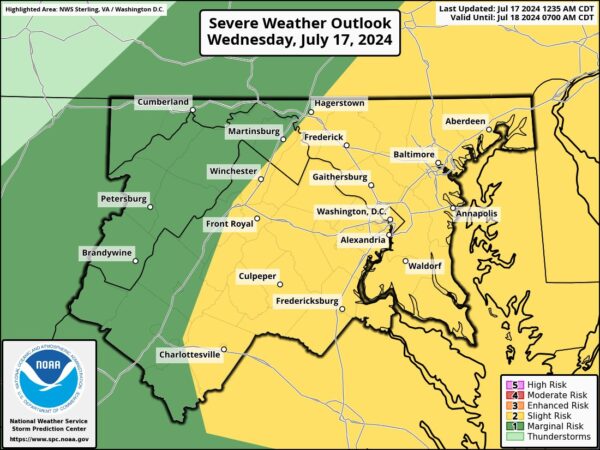
In the afternoon, instability may trigger strong to severe thunderstorms. The primary threat from these storms will be damaging winds, particularly east of the Blue Ridge Mountains. Multiple rounds of thunderstorms may occur, with some areas potentially receiving several inches of rain, which could lead to flash flooding. Urban and suburban areas, especially those already experiencing drought conditions, are at higher risk for flooding.
The cold front is expected to reach the area later tonight, potentially bringing lingering showers. Most of the severe weather activity is anticipated to exit around or shortly after midnight, with patchy fog possible if cloud cover breaks. Overnight lows will range from the 60s west of the Blue Ridge to the 70s in areas to the east.
Dangerous heat and humidity will continue today along with the threat for showers and thunderstorms. Some storms may be severe, especially along and east of the Blue Ridge. A Flood Watch is in effect for the Baltimore-DC corridor for the potential for flash flooding later today. pic.twitter.com/xQKY6efyPO
— NWS Baltimore-Washington (@NWS_BaltWash) July 17, 2024