The workweek will begin on a cool and breezy note today, but it won’t last long. High pressure moving in from Canada will bring sunny skies and calmer conditions for Monday, followed by a sharp warm-up on Tuesday. A few showers and thunderstorms could develop late Tuesday as a warm front pushes through the region.
Here’s what to expect over the next few days:
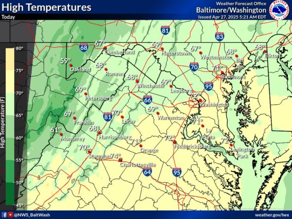
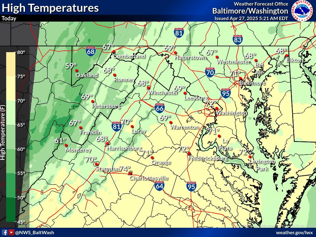
- Sunday Afternoon: Breezy and cooler with plenty of sunshine. Highs will top out in the upper 60s to low 70s, but northwesterly winds could gust up to 35 mph at times. Humidity will be low, making it feel crisp and dry.
- Monday: A chilly start in the 30s and 40s will give way to a milder, sunny afternoon. Highs will reach the mid-70s with much lighter winds compared to Sunday.
- Tuesday: A warm front will move through, sending temperatures soaring into the low to mid-80s. Expect increasing clouds and the chance for a few afternoon and evening showers or thunderstorms, especially west of I-95.
- Tuesday Night: Very mild with temperatures holding steady in the low to mid-60s. Some showers could linger, mainly west of the immediate D.C. area.